Showing posts with label pollution. Show all posts

Tuesday, July 10, 2012

Gowanus Patrol 7/2/12

We patrolled the Gowanus Canal using an aluminum skiff which we carry aboard our “Mother Ship” patrol boat, the R. Ian Fletcher.

The Feds, the EPA, are mandating a massive Superfund cleanup on the Gowanus. NYC and NYC Department of Environmental Protection continue to resist, “don’t worry, trust us, we’ve got a plan, we’ll take care of it.”

This is what we saw on the July 2nd. Just my opinion, but I don’t think we can leave it to NYC anymore. We spent the day taking educators, local bloggers and activists on patrols in the skiff so they would have these sites, and smells, firmly in mind when they went to a public meeting on the proposed EPA cleanup that evening in Brooklyn.

Message to the EPA…please BRING IT, and thanks.


Gull has faith
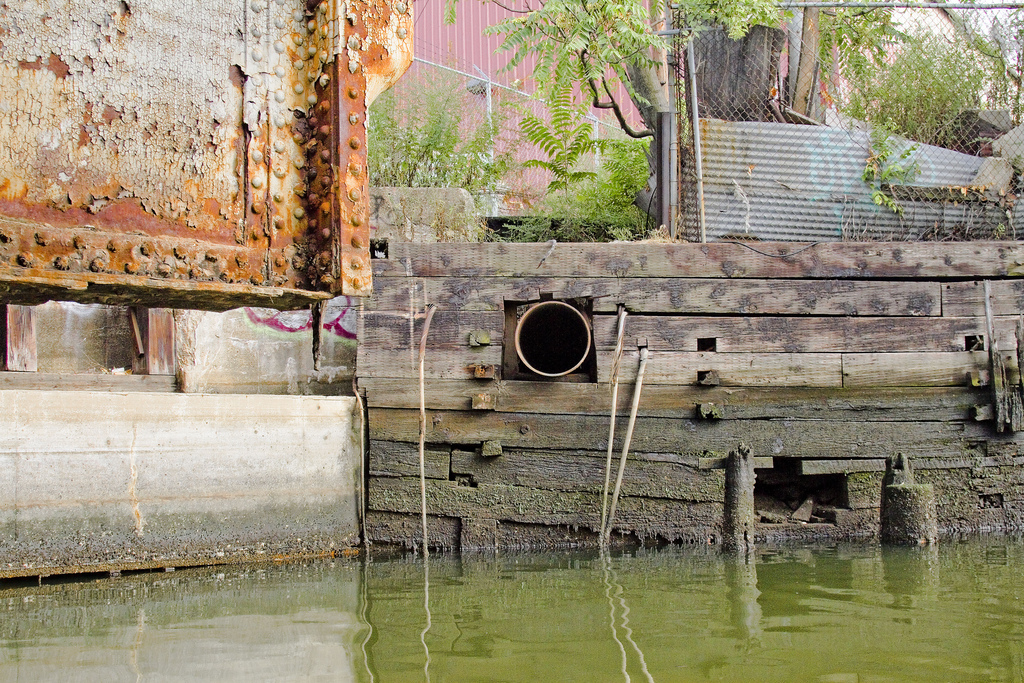
A Combined Sewer Overflow. One of many. The water is black near the outfall.

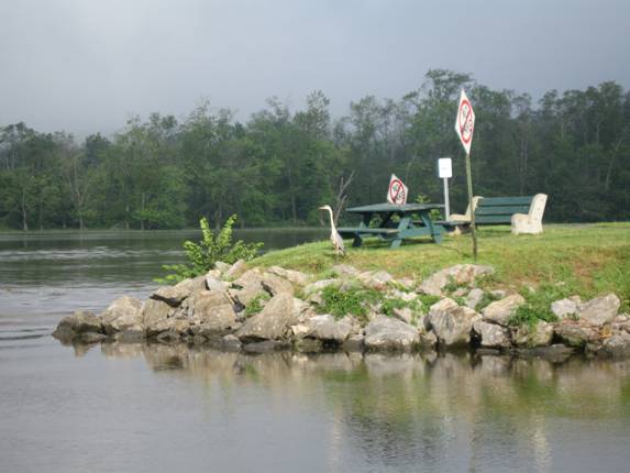
Egret
When we stir up bottom sediment it’s putrid
Public access


Gowanus snot hanging off a power cable

I'm not really sure this is water anymore. 

Massive, garage door size Combined Sewer Overflows at the inner/north end of the Canal. This wouldn’t be such a fun place in rain. A water slide from Hell.
A dead rat

A beautiful Black Crested Night Heron on the ladder at the public launch. The Gowanus used to be a beautiful and wonderfully productive salt marsh.  Life waits for us to make it so again.


Thursday, April 26, 2012

Catch of the Day 4/22


Picked this up the other night in the Port of Albany.

It’s a big molded foam filled dock float. Bigger than most.

It’s partially full of water so it’s heavy – it was even a grunt for the winch.

There was a striper fishing boat standing by when I winched it aboard. One of them said “that’s a keeper.” Funny guy.

Tuesday, April 24, 2012

Landslide into Wetland at Residential Development in Milton


The above picture is of a development in Milton, just north of Newburgh, on the ridge above the river and a recent landslide.

Property owners often cut the trees on the bank, for the view, and then often the bank collapses.

Note that the CSX freight rail line runs along the shore here. A small marsh has been captured between the bank and the rails. There is a small culvert/outlet for the marsh, too small to keep the marsh healthy, just big enough to keep the marsh drained so the railroad won’t get flooded. Although really compromised, these little stifled marshes still provide much needed habitat. This marsh just got trashed by the landslide.

We’ve all heard the expression, “death by a thousand cuts.”

This is one.

Monday, April 23, 2012

Shoreline Dumping on the Harlem


Last week we were heading southbound on the Harlem River. WCBS Producer Mary McGeever was aboard interviewing Riverkeeper Investigator Josh Verleun for a story about illegal shoreline dumping. We were showing her sites on the Harlem River and on Newtown Creek.Here are examples on the Harlem River, Bronx side:


Monday, April 16, 2012

Patrolling Pays Off

Today was our first patrol of Newtown Creek for our 2012 season.  Over the years, we've dealt with a number of businesses which have seen fit to dump waste material into the creek.  This afternoon we came across a bunch of Styrofoam sheets discarded on the bank in front of a glass company.  


Phillip Musegaas, head of the Hudson River Program at Riverkeeper who was aboard today called the business and before we left, management was outside. 


"This stuff doesn't belong to us but we're going to take care of it right away."

Patrolling pays off.

Monday, April 02, 2012

Storm Drains Mitigate Pollution in Nyack

As the sampling season rapidly approaches, we're reminded of how much trash we pickup each time we're out on the river.  Trash often washes into the river during rainstorms from the streets and our communities through drains like the one below.


Nyack is replacing these traditional open-sided storm drains with these newer models which will prevent plastic trash from entering the river via storm drains.

Bravo and thank you Nyack!

Here's what they look like:


Hudson Valley residents can join cleanups in their own communities as part of the Riverkeeper Sweep on June 2. For more information, visit riverkeeper.org/sweep.


Saturday, February 04, 2012

Irene Debris

On Jan 25th I was checking an ongoing fuel spill with boat program colleagues Rob Friedman and Tracy Brown. We found this motor box on the beach in Upper Nyack. This type of motor cover is typical on 20 to 30 foot open runabouts.  My guess is that it’s debris from one of the boats lost to ‘Irene’ last summer. I imagine we’ll be finding debris from that storm stranded on the shoreline for years to come.

Tuesday, January 24, 2012

Investigation: Hydraulic Dredging Discharge


This Jan. 23 photo shows the discharge from a hydraulic dredge at a Hudson River marina. Discharge water should not be more turbid (muddy) than the receiving waters of the Hudson River. Riverkeeper notified state and federal authorities, and is continuing to investigate.

Tuesday, September 27, 2011

Beacon Sewage Overflow

Raw sewage is flowing into the Beacon Harbor from a pipe at the northeastern corner of the harbor.

A member of the public called this sewage release into Riverkeeper's office on Saturday, September 17. Riverkeeper investigated the report, documented the discharge and called it into the NY State Department of Environmental Conservation (DEC) and authorities in the City of Beacon on Sunday, September 18.

Riverkeeper sampled in the area of the discharge on September 23. That sampling confirmed very high sewage levels (>24,196 per 100/ml, the highest our system can read). Based on this data, and the lack of public notification for this ongoing release, today we issued a press release strongly advising the public to avoid contact with the water in Beacon Harbor until the source of the spill has been fixed and testing confirms that water quality has returned to acceptable levels.


Video showing the flow rate of the spill
The blue color of the water is typical for sewage spills

The water is flowing out of this spillway and into the harbor

This is the view of the harbor with the source of the sewage overflow behind you

Debris that appears to be toilet paper clings to the branches of shrubs next to the overflowing pipe
Learn about our push for a Sewage Right to Know Law for New York State
See our historic water quality data for Beacon Harbor

Wednesday, September 21, 2011

Take A Virtual Boat Ride Through Hell


Since 2002, Riverkeeper has been engaged in pollution enforcement and litigation on Newtown Creek, most notably against ExxonMobil, to ensure that it is once again clean waterway.  Remember, before Europeans arrived in New York, Newtown Creek and the Gowanus Canal were both extremely biologically diverse marine habitats for countless species.  Since the start of the Industrial Revolution, many of these species have been forced elsewhere.


In an effort to restore this polluted waterway to its natural state, Riverkeeper Boat Captain John Lipscomb was recently joined by photographer Mitch Waxman and brownfields specialist Damion Lawyer on a day-long survey of Newtown Creek, which divides Brooklyn and Queens.  The team conducted a photographic survey of the entire shoreline of the Creek, including Dutch Kills and Maspeth Creek, as part of Riverkeeper’s work on the Newtown Creek Brownfields Opportunity Area (BOA) study.  Riverkeeper is working to complete the state funded study in partnership with Greenpoint Manufacturing and Design Center  and the Newtown Creek Alliance.  The BOA is a community-based economic development planning process focused on the cleanup and redevelopment of contaminated sites along the Creek.  The study will focus on preserving industry, cultivating new industrial uses, exploring opportunities for new infrastructure, increasing waterfront access and open space, restoring habitat, and enhancing the interconnections between those who live and work near the Creek.


Click the links below to view a map visualization of the entire shoreline survey:


For more on the BOA, please visit this link.

And some of our favorite photos from the survey. All that's missing is the awful smell coming from the Creek:

A combined sewer overflow (CSO) on Newtown Creek
A CSO on Newtown Creek
A scrap barge on Newtown Creek
A CSO on Newtown Creek
Garbage and debris in Maspeth Creek

Photos courtesy of Mitch Waxman

Tuesday, August 09, 2011

"How Is the Water?" Report Released

Today we released our report on sewage contamination in the Hudson River Estuary, "How Is the Water?"

It was a big group effort - 5 years to collect the data and 5 months to write and release the report. I'm sure this will not be our last report on the sewage contamination we are battling. It's just another point in an ongoing conversation.


We were honored to be joined by New York State Senator Adriano Espaillat and New York State Assemblyman Thomas Abinanti. We will be working with both representatives on a Sewage Right to Know law for New Yorkers.


Download the report and learn about patterns and sources of sewage in the Hudson, and view some of the preliminary news coverage:

Wednesday, July 06, 2011

The 4th of July on Patrol

We took these photos as we came southbound from Waterford folllowing the completion of our June water quality patrol. Results from our June patrol will be posted shortly.


Turtles and cormorants at Binnen Kill


Bald (headed) Eagle at Rattlesnake Island


Great Blue Heron at Catskill Point.


A little parade of boats from Hop O Nose Marina at Catskill under the Rip Van Winkle Bridge


Kayak hitchhiker at Four Mile Point


Then 3 guys in a broken down boat at Hudson…towed them to Catskill launch ramp


Folks at Coxsackie


Rip Van Winkle Bridge


The beautiful Hudson showing off this morning…

Frederic Church’s home (on hilltop) in morning ground fog