Showing posts with label Newtown Creek. Show all posts

Friday, November 09, 2012

Trash and debris stranded by Sandy along Dutch Kill and Newtown Creek 11/2

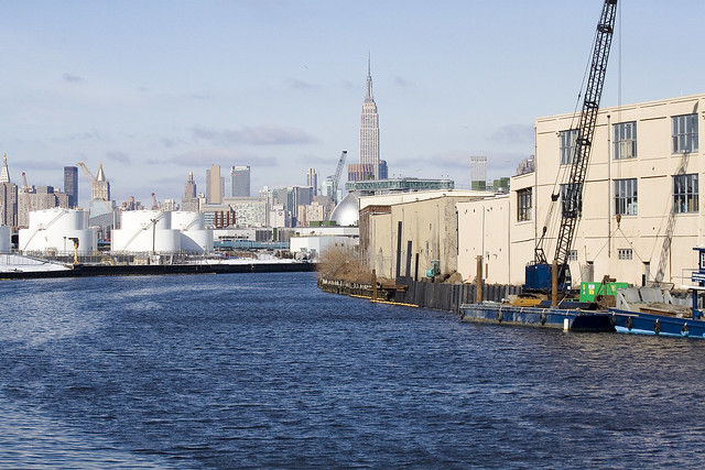
During high tide during Sandy a great deal of trash was blown by SE wind into fence along the west side of the entrance to Dutch Kill off Newtown Creek (across from “Nature Walk”). All this material remains stranded above wall but will become re-suspended at next extreme high tide – perhaps during Northeaster coming tomorrow, Wednesday 11/7.


Dutch Kill
A similar condition exists along fence on the Exxon property on south side of Newtown Creek immediately east of the Greenpoint Av Bridge

At the entrance to the English Kill (an arm of Newtown Creek) there is a section along west side where a number of drums and other debris have been blown ashore, including a dumpster and several heating oil tanks.


Friday, June 01, 2012

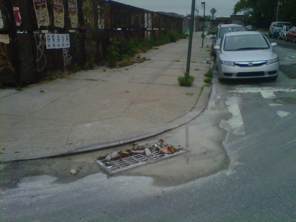
Cement runoff into storm drain in Brooklyn

About a week ago we received a watchdog report from one of our volunteers who lives in Brooklyn.  She reported that there was a cement slurry running into a storm drain from a cement facility near Newtown Creek in East Williamsburg.


We forwarded her report to DEC enforcement and an officer from DEC Region 2 was assigned to investigate.

This morning we received a call from the responding DEC police officer who issued a summons to the cement facility property owner for the concrete slurry running into the storm drain.

This is a great story of how effective watchdog reports can be. We obviously can't be everywhere at once, so receiving these types of reports from citizens throughout the region is crucial to protecting our waterways.

To learn more about how to be an effective watchdog click here.

Tuesday, May 15, 2012

Stormwater issues and ineffective absorbent boom at Pratt Oil seep

Newtown Creek today during our May water quality patrol, which began this morning.

Raining. We see several sites with very turbid discharges – we assume storm water. No sheens. No SPDES signs (pollution discharge permits).

Also, at Pratt oil seep on Queens side the absorbent boom is hung up on rip rap. It needs better rigging to be effective.

Boom at Pratt seep, Queens side.


Discharge just east of Queens side Waste Management – very close/west of Pratt seep.


Strong, turbid discharge at Waste Management on Brooklyn side under Kosciusko. We’ve seen this before. It’s only visible in rain and at low tide.


Turbid stormwater discharge next to  Exxon groundwater well discharge at Meeker Av (right hand of two)


Discharge at Empire Transit Mix. This is a storm drain, I think. It is right next to the pipe where we saw cement waste discharged years ago which led to EPA enforcement.


And just for fun, the Gowanus Canal, the lower intestine of Brooklyn


Monday, April 16, 2012

Patrolling Pays Off

Today was our first patrol of Newtown Creek for our 2012 season.  Over the years, we've dealt with a number of businesses which have seen fit to dump waste material into the creek.  This afternoon we came across a bunch of Styrofoam sheets discarded on the bank in front of a glass company.  


Phillip Musegaas, head of the Hudson River Program at Riverkeeper who was aboard today called the business and before we left, management was outside. 


"This stuff doesn't belong to us but we're going to take care of it right away."

Patrolling pays off.

Monday, March 12, 2012

Water Quality Talk in Brooklyn

Last week Riverkeeper was at the Brooklyn Brewery discussing local water quality issues with a full room of area clean water advocates.

Riverkeeper staff and volunteers were joined by
City Councilman Steve Levin and other community leaders.

The "How Is the Water?" talk was sponsored by the Newtown Creek Alliance and the brewery. The Brooklyn activist network turned out in force, including folks from the New York City Water Trail Association and the North Brooklyn Boat Club, with great questions and comments on the state of the creek and a clear passion for its future renewal.

After Riverkeeper's presentation, City Councilman Stephen Levin announced that he has introduced Sewage Right to Know legislation for New York City. Welcome news, especially for the paddlers, swimmers and fishermen in the room!

If you missed this event you have another chance to catch Riverkeeper's "How's the Water?" presentation this Thursday at the REI Soho store in Manhattan at 7pm. We hope to see you there!


Tuesday, February 21, 2012

Newtown Creek Video

This video shows the Newtown Creek in 2006, at the time when Riverkeeper and our partners in the community were investigating ExxonMobil's Greenpoint oil spill, one of the largest in U.S. history, and other pollution.


(Video via Environmental Countdown)
Today, the creek has a brighter future, thanks to the November 2010 settlement with ExxonMobil that requires the company to clean up its pollution in the soil, water and air, and to spend nearly $20 million on environmental benefit projects in the area. Riverkeeper continues to investigate pollution, ranging from sewage to oil; and we will continue to bring polluters to justice until the creek is restored.

Tuesday, December 13, 2011

An Oil Spill... In Queens


Cross-posted from the Newtown Pentacle
- photo by Mitch Waxman (February 16, 2009) 
Sadly, oil is seeping out of a bulkhead on the Queens side of the Newtown Creek.
Famously, the Greenpoint Oil Spill (click here for a link to newtowncreekalliance.org for more) occurred just across the water from this spot, but every indication points to this as being a separate event. The former site of Charles Pratt’s Queens County Oil Works, which was an approximately 18 acre parcel which would later be called the “Standard Oil Blissville works”, the sites occupation in modernity has little or nothing to do with petroleum.
Welcome, by the way, to Newtown Creek- and to the “Blissville Oil Spill”.
Just a note: For the purposes of this posting, I’m departing from the normal formatting, and the photos are presented along with the dates upon which they were captured.
- photo by Mitch Waxman (September 14, 2008)
My practice for the last several years has been to shoot everything I see along the Newtown Creek, whether or not it seems significant at the time. This practice evolved out of the paucity of photographic documentation of the place which survived the 20th century, and the effort has been made with the notion of leaving behind something for future researchers to work with. As time has gone by, and my technological capabilities have expanded, I’ve developed quite a library of shots.
The photo above depicts the site in question during the autumn of 2008, and shows the historic condition of the bulkheads.
- photo by Mitch Waxman (September 14, 2008)
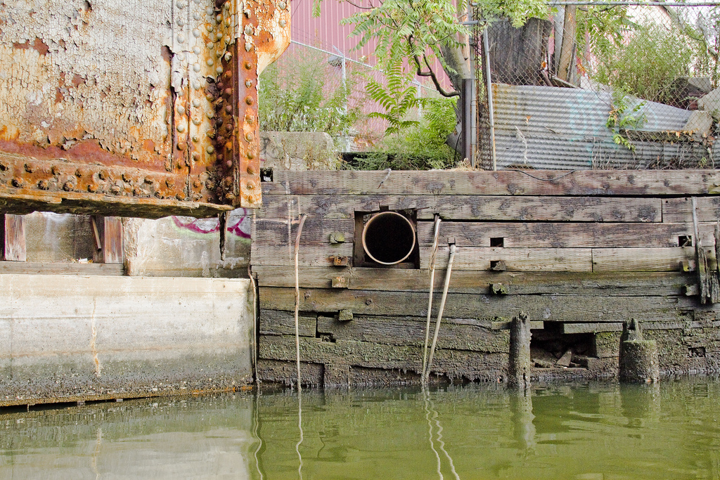
A standard codex for interpreting what one sees along the Newtown Creek states that wooden bulkheads are 19th century, reinforced concrete dates from the early to mid 20th, and steel plating is late 20th and early 21st century. This rule is not “scientific” but allows one to approximate the manufacture of these fallen docks to a relative time period. As you can observe in the shot above, the risible decay of the wooden bulkheads, and their manner of construction, speak to a long period of disuse and lack of maintenance as far as September of 2008.
- photo by Mitch Waxman (February 20, 2010)
In the winter of 2010, a crew began to install modern steel plating along this frontage, which drew my interest. Again, anything that is in a state of flux along the waterway is a point of interest for me. This project went on for several months, and was conducted from a barge with a small crane installed on it.
- photo by Mitch Waxman (February 4, 2011)
By the same period a year later, in February of 2011, the modern installation was complete. Conflicting reports on this style of bulkhead are often heard. The older wooden structures offer a structure for biological organisms to nest and shelter, but “slow” the already tepid flow of water through the narrow passages of the Creek. The steel ones “quicken” the flow, but offer no toeholds for organic life.
Modern day, (December 2011) google maps screen capture, click here or the image above for the dynamic google map. This is an industrial cul de sac today, accessed by a private driveway. The companies which use this space are largely waste management oriented, warehouse operations, furniture refinishing, or other truck based businesses. Despite the presence of freight tracks through the middle of the site, few of these companies utilize their sidings. Calvary Cemetery and the Kosciuszko Bridge loom large and distinguish the area.
The oil tanks in the center of the site betray the presence of the “Queens County Oil Works” of Charles Pratt, which were also known as the “Standard Oil Blissville Works”. Blissville, of course, is the historic name of this part of Queens which was once a residential area.
Clear plans of the area in 1936 overlaid with the 1924 aerial projection from NYCityMap. Click here to see a large version of the overlay.
Detail view of the area, click here for larger incarnation. The works were here as late as 1951, but at this point, I still haven’t been able to confirm the date they were closed down.
- photo by Mitch Waxman (August 6, 2011)
In the summer of 2011, I was tasked with photographing a “Bulkhead Survey” which members of the Newtown Creek Alliance were conducting. The good folks at Riverkeeper volunteered to take our party out on the Newtown Creek onboard their patrol boat, and when we were passing by the former Queens County Oil Works, we noticed the presence of both containment booms on the water and petroleum product flowing freely from the shoreline itself.
- photo by Mitch Waxman (August 6, 2010)
The theory which has been advanced by knowledgeable sources is that when the steel bulkheads were installed, a process in which the plating is slid down into place and then secured, and that a sealed chamber or buried pipeline was likely ruptured during the construction process which freed “the product”.
I have been asked to mention (by Newtown Creek Alliance and Riverkeeper itself) that investigation of the situation is underway, and the State and City officials responsible for policing this sort of thing are fully and enthusiastically engaged in the process.
- photo by Mitch Waxman (August 6, 2010)
The story of Charles Pratt, his “Astral Oil”, and their involvement with John D. Rockefeller’s Standard Oil Trust will be discussed in a later posting on this subject, as the lengthy history would divert attention from this otherwise serious issue. Suffice to say that the Blissville works were some 18 acres in size, and suffered several “total loss” fires in the late 19th century.
Note that this is a distinct property (and event) from the adjacent State Superfund site which is referred to as the Quanta Resources site.
- photo by Mitch Waxman (November 19, 2011)
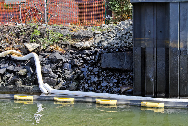
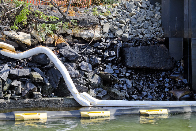
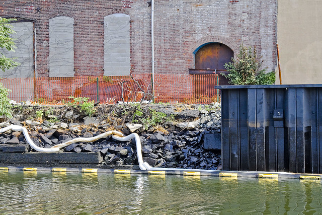
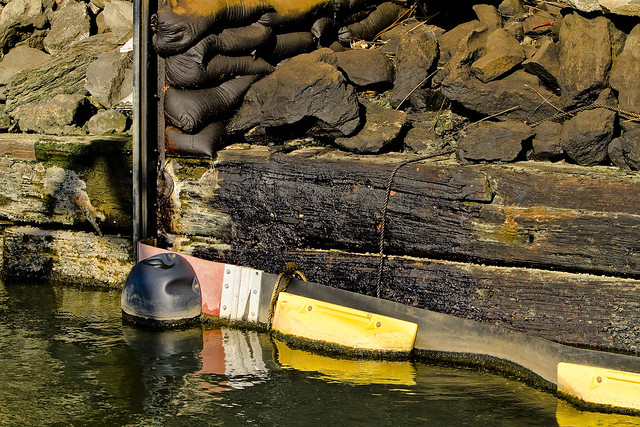
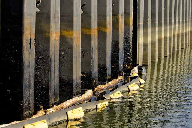
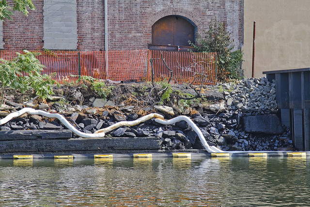
Again onboard a Riverkeeper patrol, this time in November of 2011, the overt visual presence and subtle aroma of petroleum was encountered. The black and yellow structure is what is known as a hard boom, and is designed to contain surface contamination and “floatables”. It extends to a few inches below the surface.
- photo by Mitch Waxman (November 19, 2011)
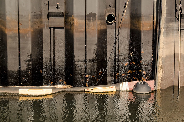
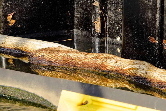
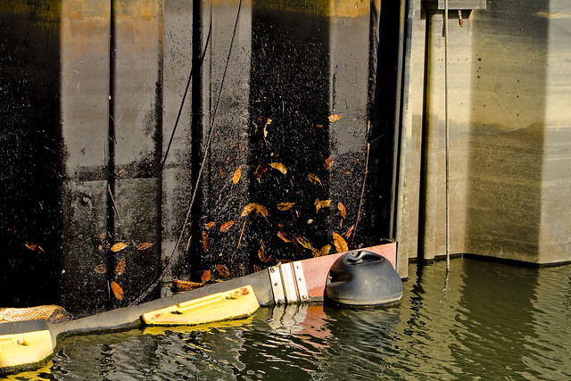
The steel plating at the site is painted with oil, undoubtedly splashed up by wave action during storms at high tide. The white objects which are saturated with petroleum products are absorbent booms, designed to wick up the free floating product.
- photo by Mitch Waxman (November 19, 2011)
The leaves in the shot above are literally stuck into the gluey residues of the oil. You can see the high tide mark left by the water on the cleaner bulkhead which is just beyond the hard boom. Perhaps this is the source of oil, which many have reported to me over the course of the last year, which has been witnessed as it floats toward the East River.
- photo by Mitch Waxman (November 19, 2011)
It is not news that there are environmental contaminants floating freely in this troubled waterway, nor is there any revelation to be found in the fact that petroleum products are commonly observed pooling and flowing about the Newtown Creek watershed.
What is news is that this is in Queens.
- photo by Mitch Waxman (August 6, 2011)
Much of the attention, and deservedly so because of the large and growing population of Greenpoint and Williamsburg, which Newtown Creek receives is all about Brooklyn. The north shore of the Creek in Queens is often left out of discussion (and from both remediation and environmental benefits funding)  because of its relatively tiny population and industrial character. One of the questions which this blog has asked since day one has been “Who can guess all there is, that might be buried down there?”.
In the case of the Blissville Oil spill, the question might as well be “How much there might be?”.
- photo by Mitch Waxman (November 19, 2011)
This is just the beginning of a new Newtown Creek story, the tale of the Blissville Oil Spill. I fear it will be the first of many such stories, as we move into the Superfund era.
Cross-posted from the Newtown Pentacle

Monday, October 17, 2011

Collaborating on Hudson River Pollution Enforcement


Much of our work on the Riverkeeper boat involves enforcement on behalf of the Hudson River and its tributaries.  While we do not have legal jurisdiction over polluters (i.e. legal investigations & arrests) we are lucky enough to work with agencies that do.  Because we're constantly out on the water, in and out of the back canals of Brooklyn, and covering all 164 miles of the Hudson River, we are often some of the first eyes to witness water pollution.
We recently brought several members of the Department of Justice's US Attorneys office for the Southern District of New York as well as members of the EPA's Region 2 Criminal Enforcement Unit for a tour of Newtown Creek and the East River.  Our focus was discussing cases throughout the Hudson Valley that we can collaborate on in the future.  You can bet that we're looking forward to working together in the future!


Riverkeeper attorney and chief investigator, Josh Verleun (far right), discussing Riverkeeper's involvement in enforcement on Newtown Creek

Wednesday, September 21, 2011

Take A Virtual Boat Ride Through Hell


Since 2002, Riverkeeper has been engaged in pollution enforcement and litigation on Newtown Creek, most notably against ExxonMobil, to ensure that it is once again clean waterway.  Remember, before Europeans arrived in New York, Newtown Creek and the Gowanus Canal were both extremely biologically diverse marine habitats for countless species.  Since the start of the Industrial Revolution, many of these species have been forced elsewhere.


In an effort to restore this polluted waterway to its natural state, Riverkeeper Boat Captain John Lipscomb was recently joined by photographer Mitch Waxman and brownfields specialist Damion Lawyer on a day-long survey of Newtown Creek, which divides Brooklyn and Queens.  The team conducted a photographic survey of the entire shoreline of the Creek, including Dutch Kills and Maspeth Creek, as part of Riverkeeper’s work on the Newtown Creek Brownfields Opportunity Area (BOA) study.  Riverkeeper is working to complete the state funded study in partnership with Greenpoint Manufacturing and Design Center  and the Newtown Creek Alliance.  The BOA is a community-based economic development planning process focused on the cleanup and redevelopment of contaminated sites along the Creek.  The study will focus on preserving industry, cultivating new industrial uses, exploring opportunities for new infrastructure, increasing waterfront access and open space, restoring habitat, and enhancing the interconnections between those who live and work near the Creek.


Click the links below to view a map visualization of the entire shoreline survey:


For more on the BOA, please visit this link.

And some of our favorite photos from the survey. All that's missing is the awful smell coming from the Creek:

A combined sewer overflow (CSO) on Newtown Creek
A CSO on Newtown Creek
A scrap barge on Newtown Creek
A CSO on Newtown Creek
Garbage and debris in Maspeth Creek

Photos courtesy of Mitch Waxman

Friday, May 21, 2010

Damaged Barges Dumping Foam into Newtown Creek


A barge remains berthed at north side of Newtown Creek just east of the Pulaski Bridge. There is reason to believe that this heavily damaged barge has been abandoned and has already lost some floatation foam to New York Harbor waters.

We have seen foam blocks on Newtown Creek on several occasions.

Other barges – also presumably owned by “Pile Foundation” - have been at a job site at the lower east side of Manhattan both north and south of the Williamsburg Bridge for several years. These barges also show heavy damage from collisions/age/rough handling and exposed floatation foam.


We have also seen foam blocks in the East River near the construction site on several occasions.


Saturday, October 03, 2009

Polluted Waters: Newtown Creek, Brooklyn

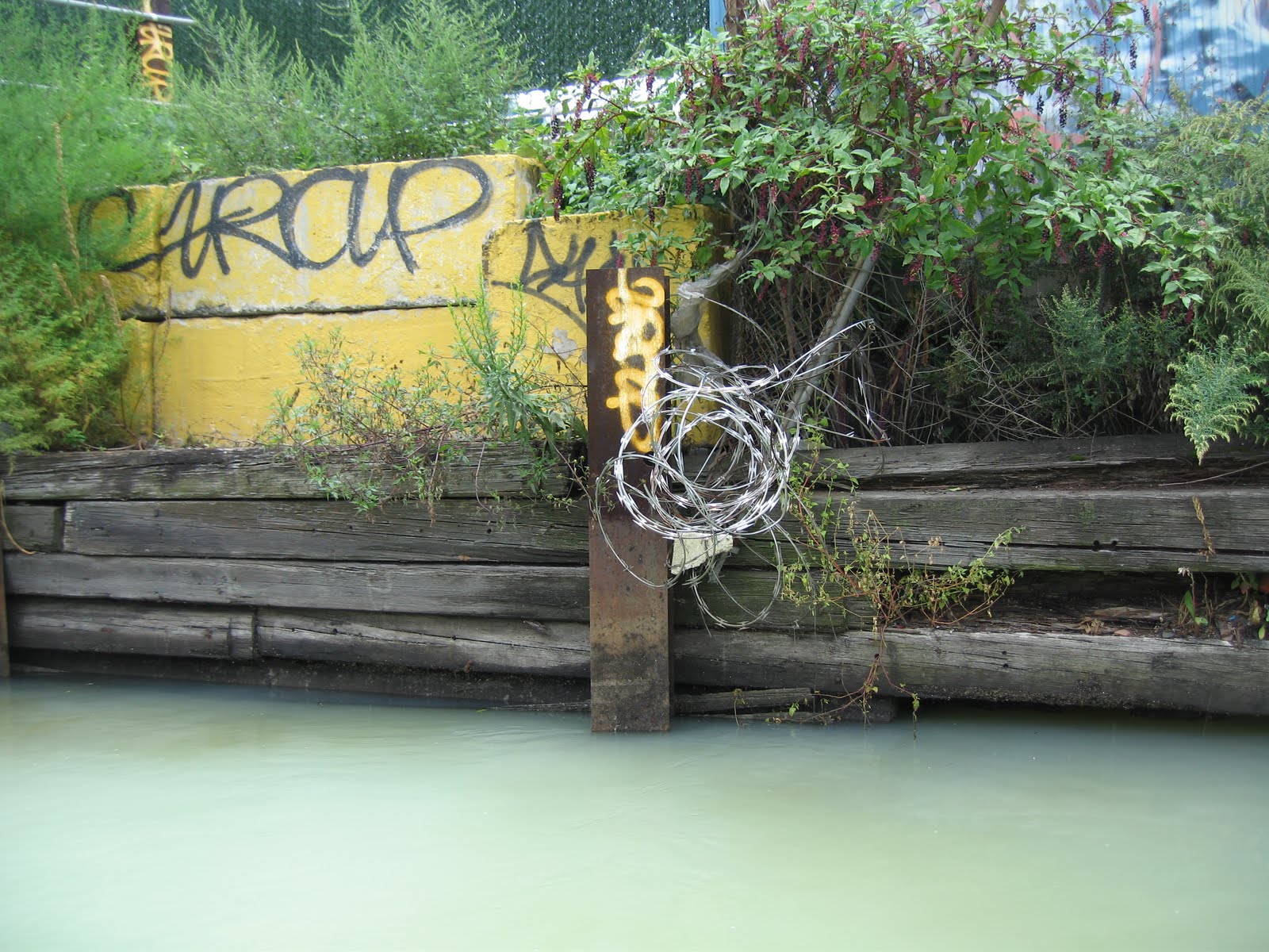
The water in the inner reaches of urban waterways like Newtown Creek and Gowanus Canal is polluted beyond comprehension. Yes, the white stuff in the foreground is water. These “out of sight – out of mind” waterways are like giant, 500 foot diameter pipes discharging a toxic mix of petroleum products, heavy metals, chemical compounds and sewage pathogens into the waters of NY Harbor and the Hudson. We have much work ahead to clean these cesspools up.

Learn more about the oil spill under Greenpoint, Brooklyn that's leaching into Newtown Creek.